Basel 1356
What happened in Basel in 1356?
On 18 October 1356, several violent earthquakes shook the city of Basel and the surrounding areas. The series of quakes began around noon, with the first damage caused by a stronger quake at approximately 6 p.m. It is assumed that most of the population moved outdoors during these tremors. Many people presumably stayed there because the ground continued to shake, sometimes severely. The largest earthquake in the series struck at around 10 p.m. With a magnitude of about 6.6, this was the strongest documented earthquake in Switzerland's history. Aftershocks continued to shake the city for many months.
The 'Basel earthquake' today: expected ShakeMap for a magnitude-6.6 quake near Basel.

Since the city of Basel had only about 6,000 inhabitants in 1356 and the strong foreshocks probably caused people to leave their homes before the main quake struck, it is assumed that the death toll was low.
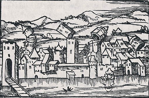
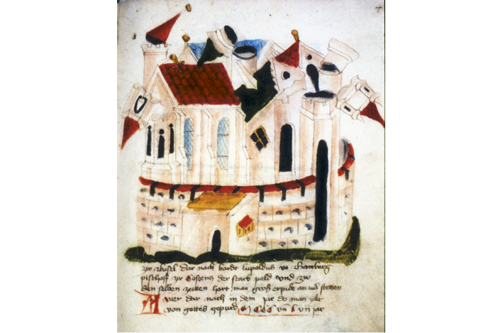
Many buildings were severely damaged by the quake and in particular by the fires that followed. The latter were caused by open fires left unattended, which ignited the shingle roofs and devastated the centre of Basel. Some churches and monasteries in the city are known to have been severely damaged. At Basel Minster, for example, the roof of the central nave collapsed and parts of the choir as well as the nave and transept suffered considerable damage. The five towers also collapsed. Evidence of this devastating event can still be seen today in a crack held together with braces on the north side of the minster, deformed walls inside the building, and the clearly visible marks of reconstruction.
After the earthquake, the city was partially uninhabitable. Settlements around Basel as well as cities further away such as Bern, Solothurn and Strasbourg were also affected by the quake. Reconstruction got under way quickly, thanks in part to Basel’s considerable wealth in the 14th century. The new outer wall built during the reconstruction works even expanded the city limits.
This relatively comprehensive picture of the disaster can be pieced together from 20 or so documents dating from shortly after the earthquake, which have survived to this day. Further numerical data and descriptions of the event stem from 1,356 documents written in the 15th, 16th, 17th or even 18th centuries. Indeed, this period was characterised by a very large number of writings about the earthquake, amounting to a veritable 'Basel seismophilia'.
Parts of this text on the Basel earthquake of 1356 appeared in a slightly modified form in the 2022 Basler Stadtbuch dossier entitled Basel bebt.
The city of Basel is located at the southern end of the Upper Rhine Graben, bordering the Black Forest massif to the north-east and the Jura Mountains to the south. The strong quakes that happen near Basel are mainly due to the geological structure of the Rhine Graben.
As a result, the area around Basel is the second highest seismic hazard zone in Switzerland after the Valais. Historically, earthquakes have been documented in Basel and its immediate surroundings since the 14th century, but there may have been a major earthquake near the Roman settlement of Augusta Raurica as far back as around AD 250.
The effects of a magnitude-6.6 earthquake in Basel were calculated as part of modelling for the Swiss earthquake model 2023. An earthquake with a similar magnitude to this can be expected in the Basel region every 2,000 to 2,500 years. If such an earthquake were to happen again today, it is estimated that around 3,000 people would be killed and approximately 21,000 injured, with damage to buildings amounting to roughly CHF 45 billion. There would be large-scale destruction in the epicentral area. Across Switzerland, around 80,000 buildings would suffer moderate to very severe damage, with approximately 45,000 buildings affected in the cantons of Basel-Stadt and Basel-Landschaft alone. This would equate to about 70% of the building stock in the canton of Basel-Stadt.