News Archive 2018
2018-12-29
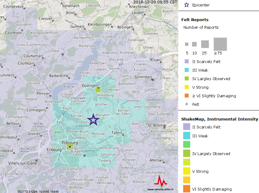
Weak Earthquake near Fribourg
On 29 December 2018 at 9:30 a weak earthquake with a magnitude of 2.9 was observed between Fribourg and Düdingen. The event was mainly felt in these two municipalities, but the Swiss Seismological Service at ETH Zurich also received felt reports also from other places within a radius of roughly 15 km. Damages are not expected due to such an event.
The region of Fribourg is well known for weak and shallow earthquakes. In the past numerous similar events were detected every year. However they are typically too weak to be felt by the public.
2018-12-19
Merry Christmas and a Happy New Year!
This year's Christmas wreath is decorated with red and orange berries. They show the location of the earthquakes with a magnitude of 2 or greater recorded by the national seismic network from January to November 2018.
We wish you a Merry Christmas and a Happy New Year!

2018-11-26
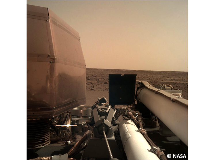
InSight landed on Mars!
On 26 November 2018 the time had come: InSight successfully landed on the Elysium plain. This was not an easy task. It was only possible thanks to technologies that had been tried and tested in earlier missions and played together perfectly. The InSight mission had to overcome additional difficulties: Compared to other Mars missions, it entered the atmosphere with a slower velocity, was heavier, landed at a higher point and at a meteorologically less favourable time due to a high risk of sandstorms. Beginning from the entry into the atmosphere, the entire landing took six minutes. By this time, the mission had already covered a distance of approximately 483 million kilometres and spent 205 days in space.
Read more...The successful landing is an important milestone in fulfilling the scientific objectives of the mission. We are particularly interested in the origin and development of Mars and its inner structure. We can therefore hardly wait until the seismometer is set down on the surface of Mars and the first measurement data arrives, which we will then immediately evaluate together with researchers from the Institute of Geophysics. InSight is thus also the start of a new era: For the first time, scientific data on the before-mentioned topics will be collected and the first results will be awaited with anticipation. First marsquake measurements are expected for early January if everything goes according to plan.
Have you missed it? Watch the landing here.
2018-11-15
Watch InSight land on Mars
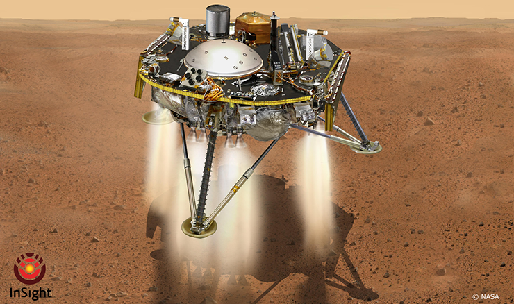
After a voyage lasting a good six months and covering some 485 million kilometres, NASA’s InSight lander is set to touch down on Mars on 26 November 2018. The landing promises to be a nail-biting spectacle: only if countless processes work together seamlessly will researchers from the Swiss Seismological Service (SED) at ETH Zurich and the Institute of Geophysics be able to gather seismic data that will reveal more about the interior of the Red Planet.
Before landing, InSight will turn so that its heat shield enters the atmosphere first. The shield protects the lander from temperatures of up to 1,500°C. Once the lander has entered the atmosphere, its parachute will deploy, slowing its initial fall velocity (385 m/s) for landing. The lander’s descent engines will fire over the last 100 metres, providing reverse thrust. A seismometer will be positioned as soon as the lander has touched down safely. The seismometer’s data-collection and control electronics were developed at ETH Zurich, and the seismic measurements it records will be analysed by seismologists from the SED and the Institute of Geophysics.
Read more...Come and help us cheer InSight on! NASA’s coverage will be broadcast live at bQm from 8.00 p.m. on 26 November 2018. The landing is scheduled for around 8.50 p.m., and the first images of Mars are expected at around 9.15 p.m. Since seating is limited, we would advise you to come early. More details can be found in the invitation flyer.
Find out more about the InSight mission and ETH Zurich’s activities at www.insight.ethz.ch.
Alternatively, you can watch the landing online here.
2018-11-03
[Available in DE/FR] Erdbeben bei Martigny
Am Samstag, dem 3. November 2018 hat sich um 01:20 Uhr (Lokalzeit) südlich von Martigny (VS) in einer Tiefe von ca. 10 km ein Erdbeben der Magnitude 2.9 ereignet.
Die Erschütterungen waren im Unterwallis, vorwiegend im Gebiet um Martigny, bis Saxon und Collonges gut zu spüren. Zudem haben auch im unteren Rhonetal bis Aigle einige Personen das Beben wahrgenommen. Dies aufgrund seiner Bodenbeschaffenheit (weiche Sedimente) und der damit verbundenen Verstärkung der Erdbebenwellen. Bei einem Erdbeben dieser Stärke sind in der Regel keine Schäden zu erwarten
Read more...Die Region um Martigny wurde bereits am 23. August dieses Jahres von einem Erdbeben am Dent de Morcles mit der Magnitude von 3.2 erschüttert (siehe Aktuellbeitrag vom 23.08.2018). Solche Erschütterungen sind für diese Region nichts Ungewöhnliches, ist das Wallis doch der Kanton mit der höchsten Erdbebenaktivität in der Schweiz.
![[Available in DE/FR] Erdbeben bei Martigny [Available in DE/FR] Erdbeben bei Martigny](/export/sites/sedsite/home/.galleries/img_news_2018/20180310_Martigny_shakemap_de.png_2063069299.png)
2018-10-23
New procedures used in test to control induced seismicity
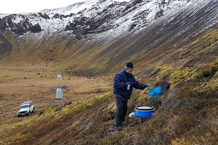
How can induced earthquakes occurring when deep geothermics are used, best be monitored, predicted and controlled? The Swiss Seismological Service (SED) at ETH Zurich is addressing this question within the framework of the COSEISMIQ project (COntrol SEISmicity and Manage Induced earthQuakes), which has just been launched near Reykjavik. In the wake of the induced earthquakes in Basel and St. Gallen, finding answers to these questions is important for all present and future geothermal energy sites, especially for Switzerland.
Together with Reykjavik Energy, GeoEnergie Suisse and scientists from Iceland, Ireland and Germany, 'adaptive traffic-light systems' will be tested under realistic conditions for the first time. The aim is to develop a system that can learn in real time and takes account of new data and local circumstances and events to minimise the risks of induced earthquakes while maximising energy extraction.
Read more...In recent weeks, as a first step, 23 seismic stations have been set up in the vicinity of the Hengill geothermal area, 30 km east of Reykjavik. Iceland is an ideal location for research because of its many successful geothermal projects, frequent instances of induced seismicity and sparse population. In a next step, induced seismicity during the stimulation of newly created boreholes will be recorded and (largely automatically) analysed. The data thus obtained should then serve as a basis for geomechanical modelling that enables the operator to observe and optimise the development of the reservoir in close to real time. The hope is that in future the adaptive system will help operators adopt targeted measures aimed at limiting induced seismicity. COSEISMIQ is part of the EU-funded GEOTHERMICA research programme.
2018-10-01
Earthquake and Tsunami in Sulawesi, Indonesia
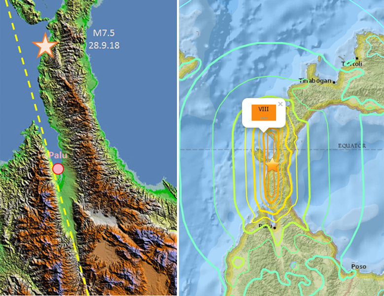
On 28 September 2018, several strong earthquakes shook the island of Sulawesi in Indonesia. The strongest earthquake, with a magnitude of 7.5, triggered a tsunami and, according to knowledge to date, claimed more than a thousand lives.
The earthquake occurred about 80 kilometres north of the provincial capital Palu on the coast at a depth of about 10 km. The quake was triggered by a sudden horizontal movement of rocks along the Palu-Koro fault. The north-south running fault through the Bay of Palu is similar in type to the San Andreas fault in California. Initial analyses indicate that the rock on both sides of the fault have shifted several metres in relation to each other in the area North of the town of Palu.
Read more...Horizontal displacements such as those of this earthquake rarely trigger large tsunamis. This usually requires a vertical movement of the seabed. When a block of rock beneath the water surface rises or falls rapidly due to an earthquake, the water column above it is raised or lowered and a tsunami is triggered. The exact cause of the tsunami in the Bay of Palu is not yet known. Possible causes are the pronounced topography of the coastal area and the seabed, whereby horizontal movements could also shift large masses of water, and / or underwater landslides caused by the quake.
After the earthquake, the tsunami waves took about half an hour to reach Palu. This appears long in comparsion to the relatively short distance to the epicentre. The reason for this is the depth of the water; the greater the depth, the faster the waves spread. At a shallow water depth of 200 m, as it is likely to prevail between the epicentre and the city of Palu, the speed of propagation is about 160 km/h. This is much slower than the speed of the seismic waves, and also much slower as if the sea depth was at 4 km, typical in the deep ocean. In this deep case, the tsunami waves would have arrived at Palu in under 10 minutes. In addition, the narrow geometry of the bay north of Palu is very likely to have significantly amplified the height of the tsunami wave.
As always, the sequence of strong quakes has redistributed the tectonic stresses in the region. In the coming days, further, sometimes violent aftershocks at the Palu-Koro fault as well as at neighbouring fault lines are to be expected. Indonesia lies on the Pacific Ring of Fire, where 90 percent of all earthquakes worldwide occur.
2018-08-23
[Available in DE/FR] Erdbeben am Dent de Morcles
Am Donnerstag, dem 23. August 2018 hat sich um 02:09 Uhr (Lokalzeit) am Dent de Morcles östlich von Evionnaz in einer Tiefe von ungefähr 7 km ein Erdbeben der Magnitude 3.2 ereignet.
Die Erschütterungen waren im Unterwallis, vor allem von Fully und Martigny bis Aigle gut zu spüren. Das Beben wurde aber auch in anderen Ortschaften im Unterwallis verspürt. In den ersten Minuten nach dem Erdbeben gingen beim Schweizerischen Erdbebendienst an der ETH Zürich bereits über 200 Verspürtmeldungen ein. Die Bodenbeschaffenheit im Rhonetal (weiche Sedimente) und die damit verbundene Verstärkung der Erdbebenwellen sind dabei für die verbreitete Wahrnehmung mitverantwortlich. Bei einem Erdbeben dieser Stärke sind keine Schäden zu erwarten.
Read more...Die Region um Saxon wurde bereits im Februar dieses Jahres von einem Erdbeben der Magnitude von 2.6 erschüttert. Im Wallis und vor allem in einem Streifen, der parallel der Haupt-Talrichtung von Leukerbad über Derborence Richtung Lac d'Emosson verläuft, ist es in den letzten Jahren immer wieder zu kleineren, spürbaren Erdbeben gekommen. Solche Erschütterungen sind für diese Region nichts Ungewöhnliches, ist das Wallis doch der Kanton mit der höchsten Erdbebenaktivität in der Schweiz.
![[Available in DE/FR] Erdbeben am Dent de Morcles [Available in DE/FR] Erdbeben am Dent de Morcles](/export/sites/sedsite/home/.galleries/img_news_2018/waveform_saxon.png_2063069299.png)
Earthquake struck the island of Lombok
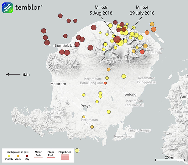
On 29 July 2018, the Indonesian island Lombok was struck by an earthquake of magnitude 6.4. Several weaker earthquakes followed until an even stronger earthquake of magnitude 6.9 occurred on 5 August 2018. It caused heavy damage to buildings as well as infrastructure and claimed almost 100 lives. The shocks were also felt strongly in Bali and caused several damages. In principle, further possibly strong earthquakes have to be anticipated during the next days to months, and the possibility of an even stronger earthquake in the near future cannot be ruled out. The current earthquakes occured in a shallow depth between 10 and 30 km; therefore, even weaker earthquakes with a magnitude of 5 or more might cause damages.
Read more...Indonesia sits atop the Pacific ‘Ring of Fire’, a seismically highly active area that also includes countries such as Japan, the Philippines or New Zealand. Ninety percent of earthquakes worldwide occur along the Ring of Fire; therefore, Indonesia is subject to a high earthquake hazard. Despite the regional differences within the country, earthquakes as strong as the Lombok earthquake can occur anywhere at any given time. Such strong shocks can be expected to occur less frequently in areas that are less at risk, such as Lombok, than in high risk areas such as Sumatra; however, the possibility can never be fully ruled out.
People who would like to travel to Indonesia during the next days or months are recommended to refer to their travel agency or local accommodation for more information on the current situation. Travellers currently in Indonesia should follow the recommendations of the local authorities as well as the most recent developments on the news. You can find general tips on what to do before, during and after an earthquake abroad here.
More information:
2018-07-18
Ready to head off for holiday... to an earthquake country?
The summer holidays are here at last. The accommodation is booked, the bags are packed and you're through airport security. What could possibly go wrong now? Many travellers are well prepared for holiday woes in the form of mosquito infestations, pickpockets or tropical heat. They have their mosquito spray to hand, took out insurance before they left and have booked an air-conditioned room. As for earthquakes, few would give them a second thought. Yet an earthquake, though much less common than the problems mentioned above, could seriously sour the holiday mood.
As with anything else, taking a few simple precautions could make all the difference. Before setting off, find out if your destination is in an area particularly prone to earthquakes (see Earthquake zones). Several of our most popular summer destinations, including Italy, Greece and Turkey, are in regions with a much higher earthquake risk than Switzerland. Other favourite destinations such as New Zealand, California and Bali are located along the Ring of Fire, a highly seismically active area where 90% of all earthquakes occur. If you are travelling to one of these areas, it may be worth taking on board the following tips.
Read more...As earthquakes occur without warning, it helps to know in advance what you should do if one does happen. The standard recommendation in Switzerland and elsewhere is: seek cover. That might be under a sturdy table or by holding a pillow over your head in bed. Many earthquake injuries are caused by falling objects such as shelf contents or ceiling or wall materials. If you run around in a panic during the quake, you are more likely to be hit by such objects. What's more, even keeping your balance can be difficult during a powerful earthquake, so you'll probably want to cling on to something that offers protection (the Director of the Seismological Service found this out for himself, as you can see in the next episode of Einstein to be broadcast on SRF).
However, as so often, there are exceptions to this rule. If you're near the sea, running inland is a better option due to the possibility of a subsequent tsunami. In Alaska, they have the following rule of thumb: if the quake is strong enough to almost knock you over, run up the nearest hill. Likewise, if you are indoors but very close to an exit, head outside. If you're already outside, stay there and keep away from buildings. Detailed recommendations on what to do can be found here. Essentially, the right action to take during an earthquake very much depends on the circumstances (the type of earthquake, the type of building, where you are, and so on).
This makes it difficult for seismologists to give general recommendations without causing undue anxiety. The most important protection against earthquakes is and will always be appropriate construction. However, judging how earthquake-resistant a building is just by looking at it is hard even for experts, so this is probably not something that you can take into account when choosing accommodation. That said, it's often the case that the newer a building is, the more likely it is to comply with the latest building standards and therefore to be earthquake-resistant.
Once the tremors are over, heavily damaged buildings should be evacuated. While making your way outside, beware of falling objects such as bricks and tiles or disconnected power lines. Aftershocks, some of them strong, are likely to occur after a major quake, and these may cause further damage. In genaral, always follow the instructions of the local authorities.
Should you wish to take further precautions, this page lists recommendations for things you can do ahead of shorter or longer trips. All the information can also be downloaded as a fact sheet.
Last but not least, don't forget that, while earthquakes are real, the risk of being harmed by one is extremely small, even in seismically active areas. For example, if you're travelling to California, the risk is 1 in 1,000,0000 per year. Driving a car there is much more dangerous, with around a 1 in 11,428 chance of being involved in a serious accident. So the message is: make a few simple preparations and then enjoy your well-deserved holidays!

2018-05-16
[Available in DE /FR] Zwei Beben in der Nähe von Châtel-St-Denis
Am Dienstag, dem 15. Mai 2018, hat sich um 17:30 Uhr (Lokalzeit) in der Nähe von Châtel-St-Denis (FR) in einer Tiefe von ungefähr 5 km ein erstes Erdbeben der Magnitude 3.1 ereignet.
Die Erschütterungen waren vorwiegend in der Umgebung von Châtel-St-Denis bis hin nach Vevey gut zu spüren. Da sich das Beben relativ nahe der Erdoberfläche ereignet hat, wurde es vor allem im Gebiet des Epizentrums relativ deutlich verspürt. Die Anzahl der Erdbebenmeldungen nahm entsprechend mit der Distanz ab. In den vergangenen Jahren haben sich in der Umgebung von Châtel-St-Denis keine grösseren Beben oder Erdbebenschwärme ereignet. Dies im Unterschied zum weiter östlich gelegenen Château-d’Oex, wo in den vergangenen Monaten zahlreiche Beben aufgetreten sind. Einen Zusammenhang zwischen dem Beben von Châtel-St-Denis und denjenigen von Château-d’Oex besteht aber nicht. Bei einem Beben dieser Stärke sind keine Schäden zu erwarten.
Read more...Am Mittwoch, dem 16. Mai 2018, hat sich um 11:32 Uhr ein zweites Beben ereignet. Die Magnitude war mit 2.9 leicht schwächer. Das Epizentrum dieses Bebens liegt am selben Ort wie jenes des ersten (etwas 2 km südwestlich von Châtel-St-Denis). Das zweite Beben ereignete sich aber vermutlich noch ein bisschen näher an der Erdoberfläche.
![[Available in DE /FR] Zwei Beben in der Nähe von Châtel-St-Denis [Available in DE /FR] Zwei Beben in der Nähe von Châtel-St-Denis](/export/sites/sedsite/home/.galleries/img_news_2018/20180515_Chatel-St-Denis_pic_dt.gif_2063069299.gif)
2018-05-05
Successful start to the InSight Mars mission
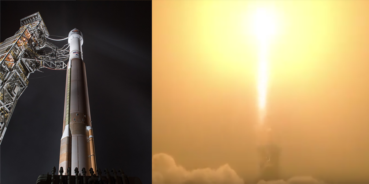
On 5 May 2018, the NASA rocket carrying the InSight lander lifted off successfully. After initially heading south from Vandenberg Air Force Base in California, after around 90 minutes the InSight separated from the launch vehicle and headed off on its trajectory to Mars. After a voyage lasting a good six months and covering 485 million kilometres, the lander is scheduled to touch down on the Red Planet on 26 November 2018. InSight will be the first mission to take a look deep below the surface of Mars to study the planet's interior by measuring the planet's heat loss and recording marsquakes.
Read more...The InSight Lander will place a seismometer, dubbed SEIS (standing for Seismic Experiment for Interior Structure), on the surface of Mars. As soon as data gathered by SEIS arrive at ETH Zurich, seismologists from the Swiss Seismological Service (SED) and the Seismology and Geodynamics Group (SEG) will analyse them as part of their routine work. However, with just one seismometer in place, this will be no easy task. Unlike on Earth, where seismologists can rely on very many recording stations to precisely determine the origin of a tremor, on Mars there will be no addtional reference points. For this reason, special care will be taken to extract as much information as possible from even the weakest signals indicating possible marsquakes, meteorite impacts or even minor tornadoes. For this purpose, staff at the Marsquake Service will combine methods taken from the early days of seismology, when there were only a few seismometers on Earth, with modern analytic methods for locating seismic events.
It is hoped that the results of the InSight mission will provide insights into one of the fundamental questions of planetary and solar system research, giving us a better understanding of the processes that created the Earth-like planets of the inner solar system (including Earth) more than 4 billion years ago.
Learn more about the InSight mission and related acitivites at ETH www.insight.ethz.ch
See what our Mars scientists are telling about the @NASAInSight mission
2018-04-26
Anthropogenic or not? Investigating the magnitude 5.5 Pohang earthquake in South Korea
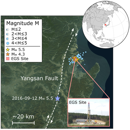
A recently published paper in Science, written by a team of the Swiss Seismological Service at ETH Zurich and collaborators from the Engineering Geology group at ETH, GFZ Potsdam and the Glasgow University, explores the potential link between a magnitude 5.5 earthquake in South Korea and a nearby geothermal project. The earthquake, which occurred on 15 November 2017, injured about 80 people and caused damage to numerous buildings in the city of Pohang. If proven to be anthropogenic, it would be the largest earthquake known to have been associated with the exploitation of deep geothermal energy.
Read more...Seismograms of induced earthquakes are generally indistinguishable from those of natural earthquakes. Therefore, investigations focus on a range of indicators, taking into account the location of earthquakes, their depths, and the history of stimulation activities conducted underground. By analyzing publically available continuous waveform and geodetic data from satellites, the paper contributes to the understanding of the nature of the event.
The study shows that the mainshock and its largest aftershocks occurred within 2 km distance or less of the geothermal site. Furthermore, they are located within 1.5 km distance of an induced event, which occurred in April 2017 during one of the underground stimulation operations. These locations are confirmed by a Korean study, which has been simultaneously published in Science. In general, the closer an earthquake sequence is located to a geothermal site and to previous related seismic activity, as well as the sooner it happens after underground operations, the greater the chance of being related to it. The mainshock and the 46 aftershocks detected between 15 and 30 November 2017 all occurred at depths of 3 to 7 kilometres. Such depths are unusually shallow when compared to previously registered natural events in the area. The analysis of satellite data illustrates that the mainshock displaced the surface of the earth permanently by up to 4 cm, indicating that the activated, and previously unknown fault, is a steeply dipping and very shallow thrust fault that passes directly beneath the bottom hole section.
These indications combined lead to the conclusion that a connection between the magnitude 5.5 earthquake in South Korea and the nearby geothermal project is plausible. However, the mainshock occurred about two months after the last stimulation activities. So far, there is no quantitative model available that relates the injection activities conducted to the occurrence of this event. The Korean government has appointed an independent expert commission to examine all pieces of evidence and to evaluate if the event was triggered or induced by the nearby stimulation activities. To our understanding, the commission will (re-)analyze all available data and models, including microseismicity data, injection volumes, reservoir pressures, and detailed hydrological and geological data, which are essential to understand the relation between the injection operations and the earthquake sequence.
The Swiss Seismological Service (SED) at ETH Zurich has first informed the public (see SED news) in November 2017 about the Pohang earthquake in the context of the release of a good practice report on induced seismicity. At the same time, Geo-Energie Suisse AG had notified the canton of Jura, where currently the only EGS-style deep geothermal project in Switzerland has applied for a construction permit. In consequence, the canton instructed Geo-Energie Suisse AG to evaluate potential implications for the planned Haute-Sorne geothermal project. An immerged understanding of the link between the magnitude 5.5 Pohang earthquake and the nearby geothermal project is crucial for a safe and sustainable future exploitation of geothermal energy.
2018-04-19
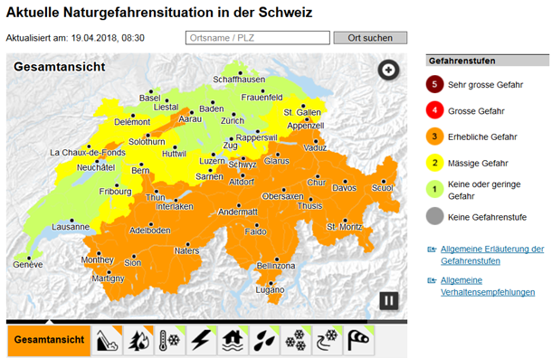
Bundesrat bewilligt neues Massnahmenpaket zum Schutz vor Naturgefahren
Im Rahmen des Projekts «Optimierung von Warnung und Alarmierung bei Naturgefahren» (OWARNA) verbessern Bund und Kantone seit 2010 laufend ihre Zusammenarbeit sowie Vorhersagen, Warnungen und Informationen bei Naturereignissen wie Hochwasser, Sturm, Lawinen oder Erdbeben. Die zuständigen Fachstellen des Bundes koordinieren ihre Anstrengungen im Lenkungsausschuss «Intervention Naturgefahren» (LAINAT). Der Bundesrat hat an seiner Sitzung vom 18. April 2018 den neuesten OWARNA-Bericht zur Kenntnis genommen und für die Periode von 2019 bis 2023 entsprechende Ressourcen bewilligt. Neben der Fortführung der bisherigen Massnahmen steht in den nächsten Jahren vor allem die Anpassung und Weiterentwicklung von Produkten und Warnungen zu klimatischen Gefahren im Vordergrund.
Read more...Weitere Informationen finden Sie hier.
Die Naturgefahrenfachstellen des Bundes:
2018-04-18
Alpine orogeny: Did the mountains form after ballast was jettisoned, rather than after being squeezed up in a collision between tectonic plates?
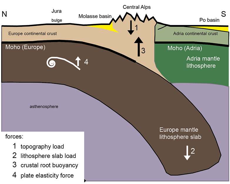
A recently published new model of the Alpine orogeny suggests that the rocks comprising the Alps rose to form a mountain range because they broke free of the heavier lower layer of the subducting European plate. This is the theory proposed by Edi Kissling from the Institute of Geophysics at ETH Zurich and Fritz Schlunegger from the Institute of Geological Sciences at the University of Bern. Previous assumptions were based on the hypothesis that the Alps were pushed up when two tectonic plates, the Adriatic in the south and the European in the north, collided. However, various recent geophysical and geological findings contradict the old bulldozer model.
Read more...The rigid rocky shell of the Earth - the lithosphere - is divided into plates that float, like rafts, on the viscous mantle beneath. These plates consist of two layers, the crust on top and the so-called mantle lithosphere underneath. The crust provides uplift and prevents the heavier mantle lithosphere from sinking into the mantle. The oceanic parts of lithospheric plates have a far thinner crust than the plates' continental parts. This makes them far less buoyant, so in so-called subduction zones the oceanic lithosphere can sink as a whole in the mantle and thereby help to push the continental part of the plate across the Earth's surface.
When the Alpine orogeny began, such a subduction occurred, when the former oceanic part of Europe was pushed underneath the Adria/African continent further south. After the whole ocean was subducted, the two continental lithospheric plates collided, much like two rafts might do. According to the previous orogenic model for the Swiss Central Alps, the collision between the two continental plates pushed together the rock material between them, causing it to surge upwards.
But recent geophysical data on the deep structure of the Alps and geological findings about how the Swiss Mittelland (or Swiss Plateau) arose indicate that this coming together, if anything, only played a very minor role in the formation of the mountain range. Instead, the Alps were pushed up to form mountains because the continental crust had freed itself from the heavy lower layer of the subducting European plate. This gave the crust, which is up to 60 km thick, tremendous additional uplift, and it has easily borne the weight of the mountains ever since, similarly to the way in which icebergs float on water. The greater uplift of the continental crust is constantly compensating for the height of the mountain range, which would otherwise decrease through erosion processes. Rivers and glaciers shape the mountains by carrying away soil and depositing sedimentation in the foreland basin, previously on the Swiss Plateau and today in the Po Valley.
So the concepts looming largest in the new model on the formation of the Alps are the floating tectonic plate's gravitational (and thus vertical) forces. This differentiates the model posited by the two authors from the previous bulldozer model, in which horizontal forces predominate.
Publication: "Rollback orogeny model for the evolution of the Swiss Alps", Tectonics, 2018
Further information: Edi Kissling, Fritz Schlunegger
2018-04-08
[Available in DE/FR] Neues Beben in der Nähe von Château-d’Oex
Am Sonntag, dem 8. April 2018 hat sich um 23:50 Uhr (Lokalzeit) in der Nähe von Château-d’Oex (VD) in einer Tiefe von ungefähr 6 km ein Erdbeben der Magnitude 2.9 ereignet.
Die Erschütterungen waren vorwiegend im Gebiet um Château-d’Oex gut zu spüren. Zudem haben auch im unteren Rhonetal viele Personen das Beben wahrgenommen. Dies aufgrund seiner Bodenbeschaffenheit (weiche Sedimente) und der damit verbundenen Verstärkung der Erdbebenwellen. Bei einem Erdbeben dieser Stärke sind in der Regel keine Schäden zu erwarten.
Read more...Die Region um Château-d’Oex wurde bereits 2016 und 2017 von zahlreichen Erdbeben erschüttert. Das stärkste Beben mit einer Magnitude von 4.3, gefolgt von zahlreichen Nachbeben, ereignete sich am 1. Juli 2017. Das Beben vom Sonntag wurde etwa 3 km südöstlich der Erdbebenschwärme im Jahr 2016 und 2017 lokalisiert.
![[Available in DE/FR] Neues Beben in der Nähe von Château-d’Oex [Available in DE/FR] Neues Beben in der Nähe von Château-d’Oex](/export/sites/sedsite/home/.galleries/img_news_2018/shakemap_Chateau-dOex.png_2063069299.png)
2018-03-12
[Available in DE] Erdbeben an der deutsch-schweizerischen Grenze nahe Laufenburg
Am Montag, 12. März 2018 hat sich kurz nach Mitternacht um 00:29 Uhr (Lokalzeit) ein Erdbeben der Magnitude 3.1 in Deutschland ereignet, ungefähr 13 km nördlich von Laufenburg. Das Erdbeben ereignete sich in 17 km Tiefe und wurde in der Nähe des Epizentrums und auch auf der schweizerischen Seite der Grenze deutlich verspürt. Schäden sind bei einem Erdbeben dieser Stärke in der Regel nicht zu erwarten.
2018-02-08
Using seismic measuring devices to record avalanches
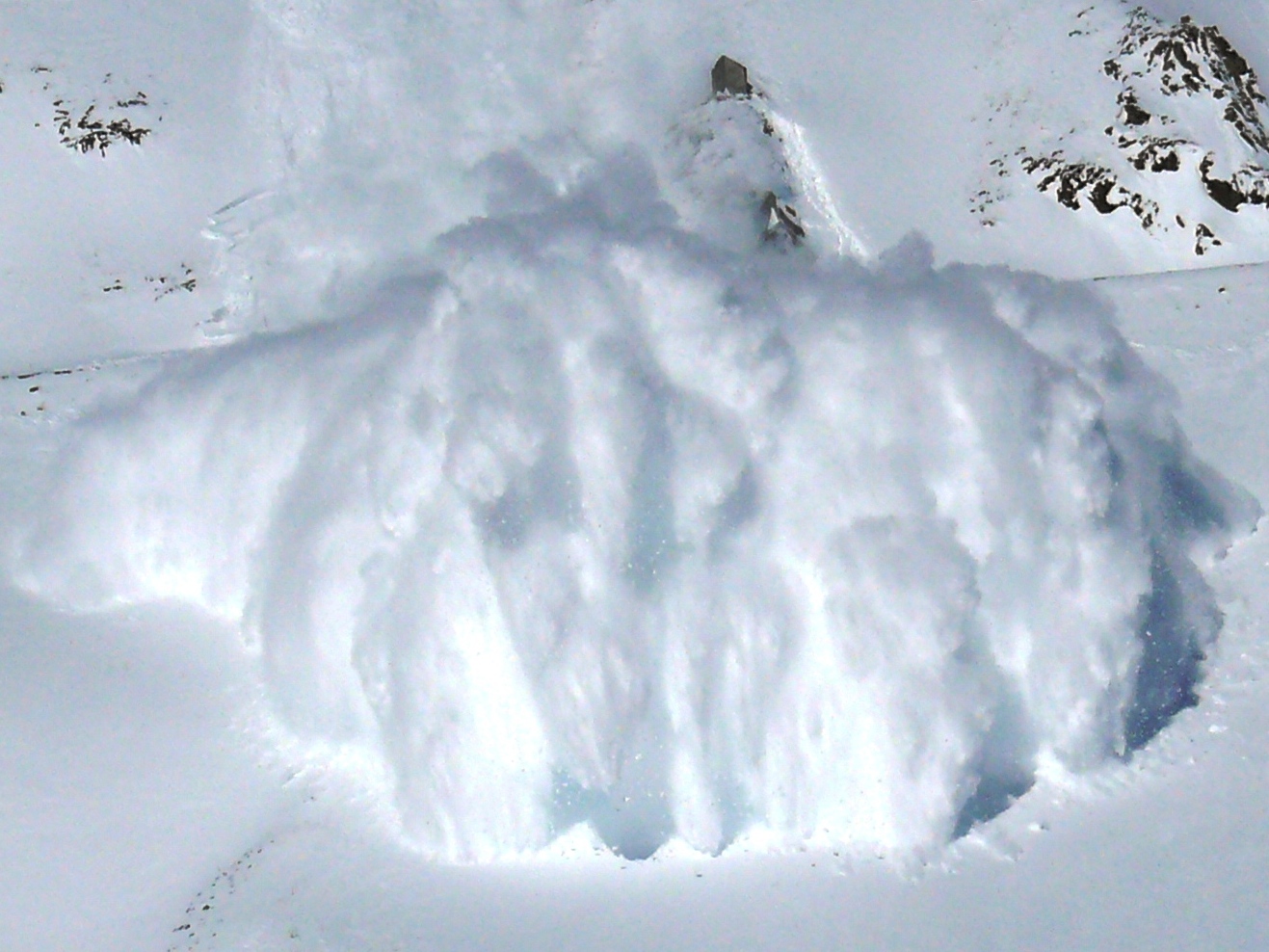
Avalanches pose a danger to mountain villages and snow sports enthusiasts. Some recent avalanches have provided important information for reliably assessing avalanche danger. However, since many avalanches fall at night or in uninhabited areas, there is often uncertainty about when they occurred and how many actually swept down into the valleys below. A joint project by the Swiss Seismological Service (SED) at the ETH Zurich and the WSL Institute for Snow and Avalanche Research (SLF) showed that seismic measurements could help determine such facts.
Read more...However, there were a number of difficulties to overcome. Unlike earthquakes, the signals associated with avalanches have neither a clear beginning nor distinct wave phases. This makes avalanche falls hard to detect using conventional seismic methods. Furthermore, signal quality suffers from the continuous motion of descending avalanches. So researchers at the SED developed a computer model that uses special methods to process these signals. The model was tested on more than 350 real avalanches recorded by the SLF above Davos in 2012.
The results are promising: the computer model automatically recorded over 90% of all avalanche falls. Fine-tuning their detection would necessitate deploying a higher number of sensors in a more sophisticated configuration. The SED, in collaboration with the SLF, now intends to further investigate this and thereby make an important contribution towards forecasting avalanche danger.
Publication: Heck, M., Hammer, C., van Herwijnen, A., Schweizer, J., and Fäh, D.: Automatic detection of snow avalanches in continuous seismic data using hidden Markov models, Nat. Hazards Earth Syst. Sci., 18, 383-396, https://doi.org/10.5194/nhess-18-383-2018, 2018.
2018-02-01
[Available in DE / FR] Erneutes Erdbeben bei Bludenz (A)
Am Donnerstag, den 1. Februar 2018, hat sich um 02:47 Uhr (Lokalzeit) ein Erdbeben der Magnitude 4.1 ca. 10 km östlich von Bludenz ereignet. Bludenz liegt am nördlichen Ende des Montafon-Tals im Bundesland Vorarlberg in Österreich. Das Erdbeben wurde nach ersten Analysen ziemlich nahe an der Oberfläche lokalisiert, die Tiefe ist aber aufgrund der Entfernung zu den nächsten Messstationen nur sehr unsicher zu bestimmen. Bei einem Erdbeben dieser Stärke sind kleinere Schäden in der Nähe des Epizentrums nicht auszuschliessen.
Read more...
Gemäss den Berichten, welche auf unserer Webseite in der ersten Stunde nach dem Erdbeben eingegangen sind, war das Erdbeben auch in Liechtenstein und in weiten Teilen der (Ost-)Schweiz, insbesondere in den Kantonen St. Gallen und Graubünden deutlich spürbar. Schäden sind in der Schweiz keine zu erwarten.
Dies ist das zweite deutlich verspürte Beben im Silvretta-Gebirge innerhalb der letzten zwei Wochen. Schon am 17. Januar 2018 hatte sich 13 km östlich von Bludenz ein Erdbeben mit einer Magnitude von 4.1 ereignet, das in der Schweiz (vor allem in der Ostschweiz) deutlich verspürt wurde.
2018-01-25
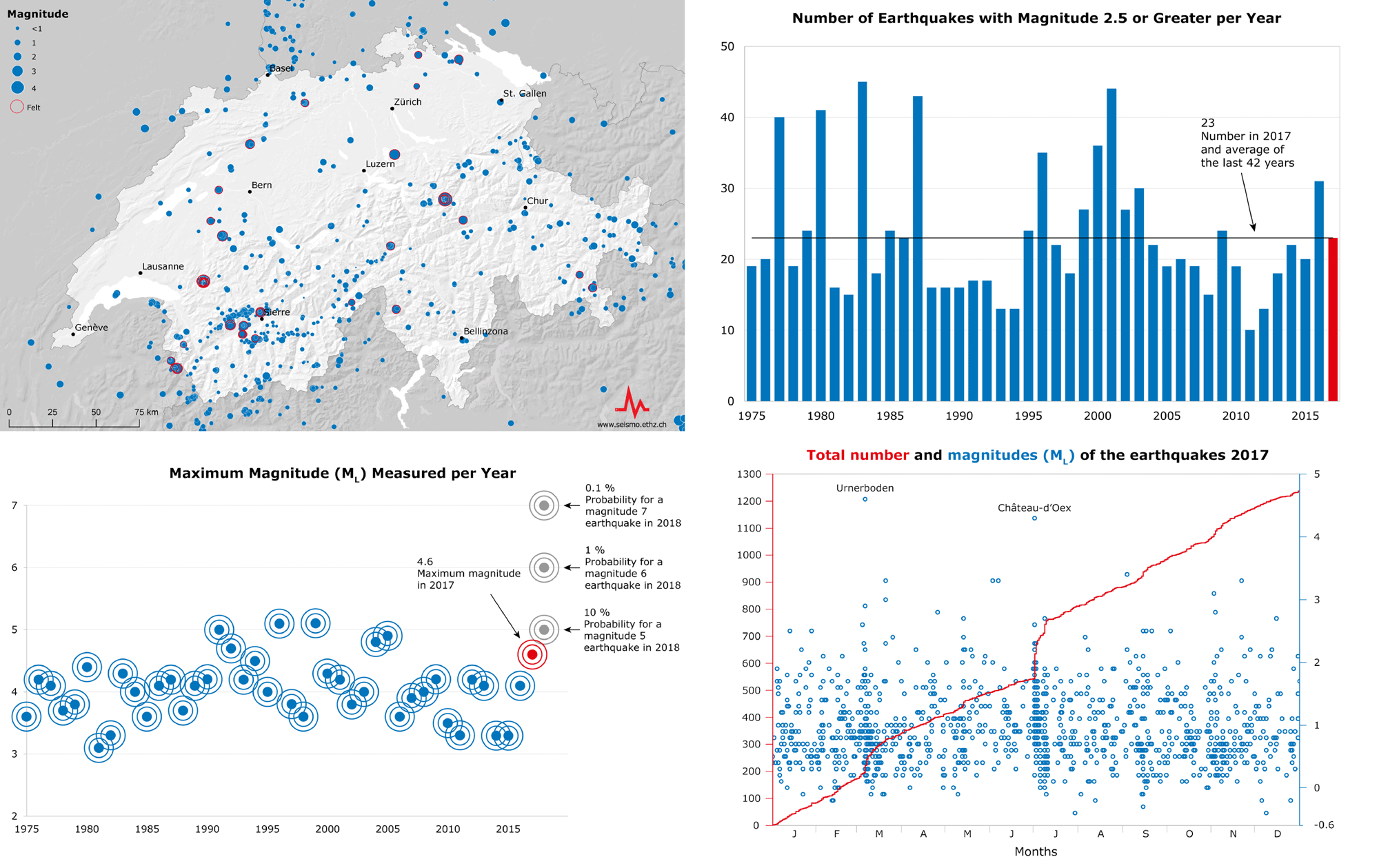
Earthquakes in Switzerland in 2017: an overview
Seismic events in 2017 once again showed that Switzerland is an earthquake country. There were two widely felt earthquakes with magnitudes above 4 and hundreds of aftershocks. Furthermore, the Swiss Seismological Service (SED) at ETH Zurich recorded more small quakes than ever before. In all, some 1'230 earthquakes were registered in Switzerland and its neighbouring countries in 2017.
Read more...On 3 March 2017, Switzerland was shaken by the strongest earthquake in more than 10 years. The earthquake with a magnitude of 4.6 occurred near Urnerboden in the border area between Uri, Schwyz and Glarus. It was felt in many parts of Switzerland and caused some minor damage to buildings near the epicentre and 100 aftershocks. The last earthquake larger than this, with a magnitude of 4.9, occurred on 8 September 2005 near Vallorcine (France) just across the Swiss border close to Martigny (VS). A second widely felt earthquake in 2017 took place on 1 July near Château-d'Oex (VD). This earthquake had a magnitude of 4.3 and triggered approximately 240 aftershocks, some of which were also felt.
Overall, in 2017 the SED registered and located more events than ever before: around 1'230 earthquakes in Switzerland and its neighbouring countries. More than 700 of these were microearthquakes, with magnitudes of less than 1.0 to -0.4. Such earthquakes are becoming increasingly “visible” in some parts of the country thanks to the improvement of Switzerland's seismic measuring system, which is making an important contribution towards gaining a deeper understanding of the structures and processes in the country's subsurface. In 2017, 23 earthquakes occurred with magnitudes of 2.5 or higher, in line with the average for the past 42 years. The earthquake activity was concentrated mainly in the Valais, Grisons and the area along the Alpine front.
Furthermore, earthquakes were clearly felt last year by sections of the Swiss population near Vallorcine (France) on 20 March (magnitude 3.0), near Sion (VS) on 2 June and 5 August (with magnitudes of 3.3 and 2.4 respectively), as well as near Zug (ZG) on 21 November (magnitude 3.3).
Year-by-year fluctuations in earthquake frequency are normal and do not permit conclusive forecasts of future seismicity. As a rule, damaging earthquakes with a magnitude of 6 occur in Switzerland once in every 50 to 150 years. The probability of this occurring in 2018 is therefore about 1 percent.
2018-01-17
[Available in DE / FR] Erdbeben bei Bludenz (A) auch in der Schweiz deutlich verspürt
Am Mittwoch, 17. Januar 2018 hat sich um 20:07 Uhr (Lokalzeit) ein Erdbeben der Magnitude 4.1 13 km östlich von Bludenz (Vorarlberg, Österreich) ereignet. Bludenz ist das nördliche Ende des 39 km langen Montafon-Tals. Das Erdbeben war nach ersten Analysen ziemlich oberflächennah, die Tiefe ist aber aufgrund der Entfernung zu den nächsten Messstationen nur sehr unsicher zu bestimmen. Kleinere Schäden sind bei einem Erdbeben dieser Stärke in der Nähe des Epizentrums vereinzelt möglich.
Das Beben war auch in weiten Teilen der (Ost-)Schweiz, insbesondere im Raum St.Gallen (56 km Entfernung zum Epizentrum) deutlich spürbar.
Erdbeben sind im Silvretta-Gebirge keine Seltenheit. Bereits am 8. Januar 2018 hatte sich an der Grenze zwischen Vorarlberg und Tirol ein leichtes Erdbeben mit einer Magnitude von 2.9 ereignet, das in der Region schwach verspürt wurde.
![[Available in DE / FR] Erdbeben bei Bludenz (A) auch in der Schweiz deutlich verspürt [Available in DE / FR] Erdbeben bei Bludenz (A) auch in der Schweiz deutlich verspürt](/export/sites/sedsite/home/.galleries/img_news_2018/Bludenz_20170117.PNG_2063069299.png)
![[Available in DE / FR] Erneutes Erdbeben bei Bludenz (A) [Available in DE / FR] Erneutes Erdbeben bei Bludenz (A)](/export/sites/sedsite/home/.galleries/img_news_2018/waveform_montafon_20180201.png_2063069299.png)
