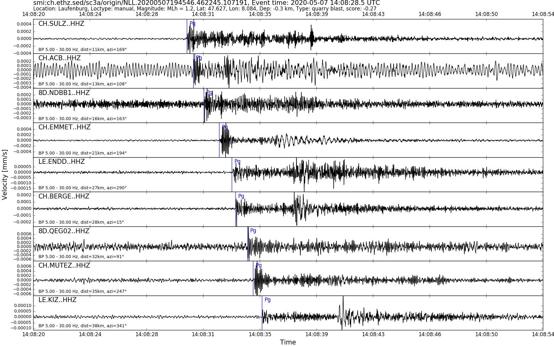
| Local time | 2020-05-07 16:08:28 |
|---|---|
| UTC Time | 2020-05-07 14:08:28 |
| Event Type | quarry blast |
| Latitude / Longitude | 47.63 / 8.08 |
| Swiss Coordinates | 648526 / 275326 |
| Magnitude | 1.2 |
| Magnitude Type | MLh |
| Location | Laufenburg |
| Depth [km] | - |
| Location Type | manual |
| Agency | SED |
| Last Update | 07-05-2020 19:45:48 |
| Danger level | 0 (as defined by federal agencies with responsibility for natural hazards) |
| Origin ID & Metadata | smi:ch.ethz.sed/sc3a/origin/NLL.20200507194546.462245.107191 |
|
GSE 2.1 provisional format |
|---|
| BEGIN GSE2.1 MSG_TYPE DATA MSG_ID 2020/05/07_021252478 CHE_NDC DATA_TYPE BULLETIN GSE2.1:short Reviewed Event Bulletin (REB) of the CHE_NDC for May 07, 2020, 02:08:28.565 EVENT 2020/05/07_020828565 LAUFENBURG Date Time Err RMS Latitude Longitude Smaj Smin Az Depth Err Ndef Nsta Gap mdist Mdist Qual Author OrigID 2020/05/07 14:08:28.57 0.21 47.6252 8.0884 11017.1 2316.6 158 -0.4 2.7 9 9 109 0.10 0.70 a i uk SED -------- Magnitude Err Nsta Author OrigID MLh 1.3 0.2 6 SED -------- Sta Dist EvAz Phase Time TRes Azim AzRes Slow SRes Def SNR Amp Per Qual Magnitude ArrID SULZ 0.10 171.4 P 14:08:30.935 0.0 ___ 283.6 a__ MLh 1.5 -------- METMA 0.14 52.0 P 14:08:31.805 0.0 ___ 115.8 a__ MLh 1.2 -------- EMMET 0.19 195.7 P 14:08:33.030 0.0 ___ 248.3 a__ MLh 1.7 -------- BERGE 0.25 14.3 P 14:08:34.095 0.0 ___ 65.0 a__ MLh 1.2 -------- MUTEZ 0.32 248.3 P 14:08:35.300 -0.1 ___ 64.6 a__ MLh 1.3 -------- KIZ 0.35 341.6 P 14:08:35.830 0.0 ___ 33.7 a__ MLh 1.1 -------- EMING 0.58 62.2 P 14:08:42.565 2.3 ___ a__ -------- BOURR 0.63 248.4 P 14:08:43.205 1.8 ___ a__ -------- MTIA3 0.70 248.8 P 14:08:44.164 1.4 ___ a__ -------- BFO 0.72 12.8 P 14:08:42.888 ___ a__ -------- STOP |