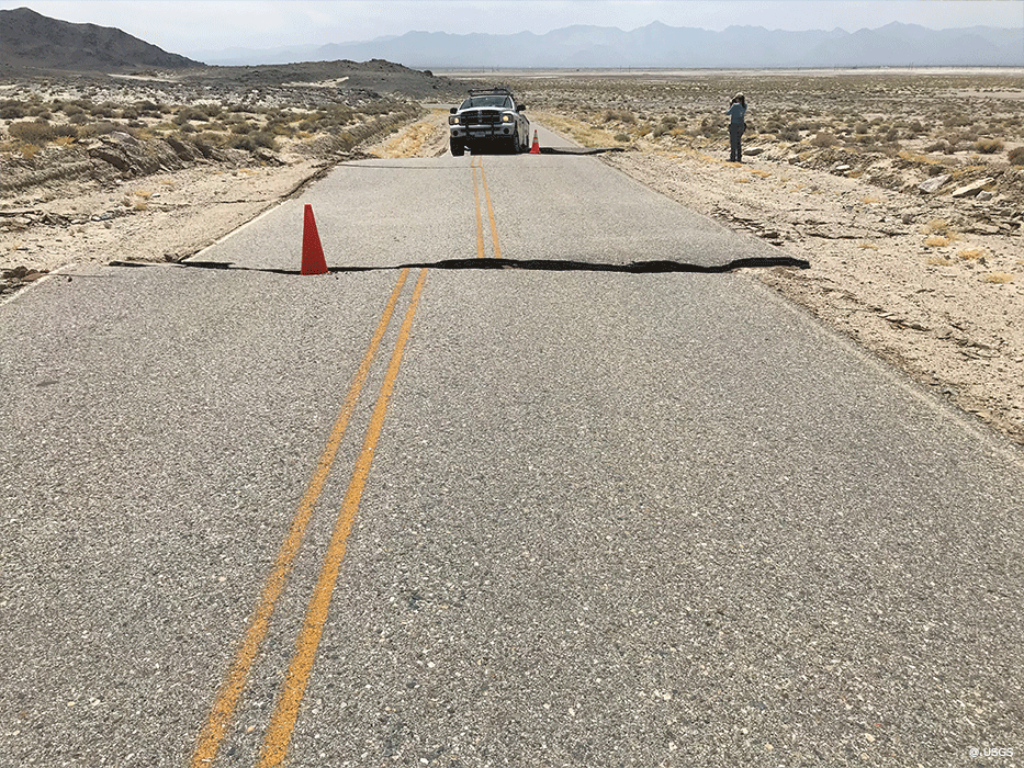
The effects of an earthquake depend on its magnitude, depth, and location. As a rule of thumb, the bigger the magnitude and the closer the earthquake to the subsurface as well as to (densely) populated areas, the greater their potential consequences.
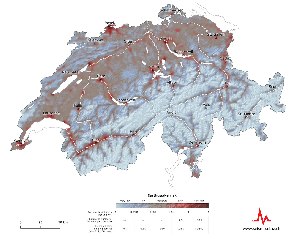
Earthquake risk (or seismic risk) quantifies the possible effects of earthquakes on buildings and the associated financial and human losses. To determine the earthquake risk, detailed information about the earthquake hazard, the influence of local subsoil, the vulnerability of buildings, and the people and assets affected are combined in a model.
- Over a 100-year period, earthquakes in Switzerland can be expected to cause economic damage of CHF 11 to 44 billion to buildings and their contents (such as furniture) alone.
- In total, around 150 to 1,600 people would lose their lives and an estimated 40,000 to 175,000 would become homeless on a short-term or long-term basis.
- On top of this, there is damage to infrastructure and losses due to other effects of earthquakes such as landslides, fires or business interruptions.
However, these are not yet included in the model. The earthquake risk is not evenly distributed over time but is dominated by rare, catastrophic earthquakes that usually happen without warning.
- Detailed information about the earthquake risk in Switzerland can be found here.
- A series of earthquake scenarios illustrating potential effects of earthquakes are presented here.
In principle, near the epicentre, earthquakes with a magnitude of 2.5 or above can be felt. Only rarely do we receive earthquake notifications for events with a magnitude of just under 2. Earthquakes with magnitudes of 3 or higher are felt by large numbers of people; at magnitudes of between 4 and 5 they can be felt within a radius of up to 200 kilometres; and at magnitudes of 5 or more they can be felt up to several hundred kilometres away under some circumstances.
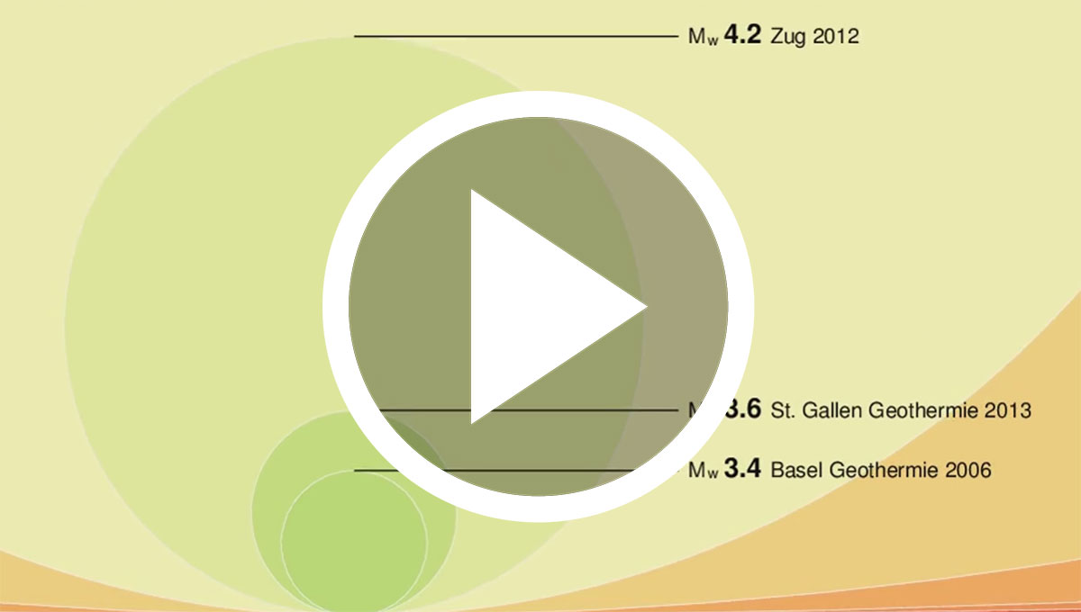
These increasing radii are due to the fact that the energy released by an earthquake increases by a factor of 30 per level of magnitude, making a magnitude 5 earthquake 30 times stronger than a magnitude 4 earthquake.
You can see how the energy released increases exponentially in the video.
The impact of an earthquake on the surface (i.e. on buildings, people, the environment and infrastructure) is described according to a 12-level intensity scale (see EMS-98 below).
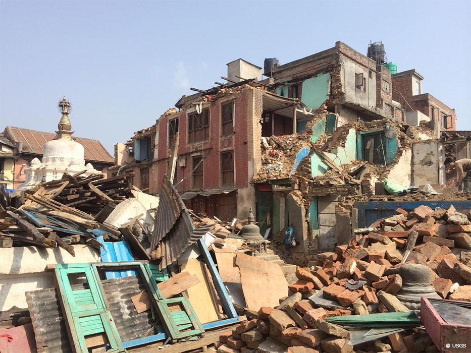
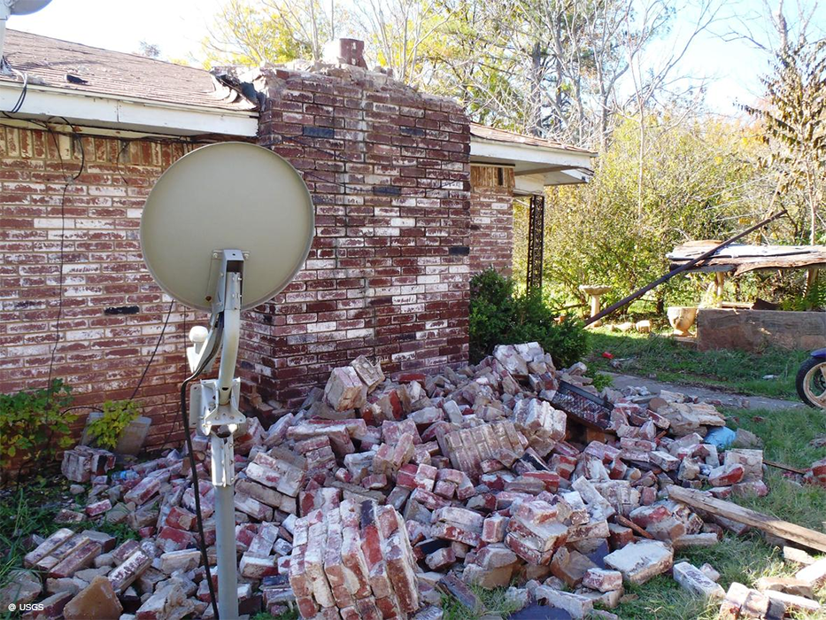
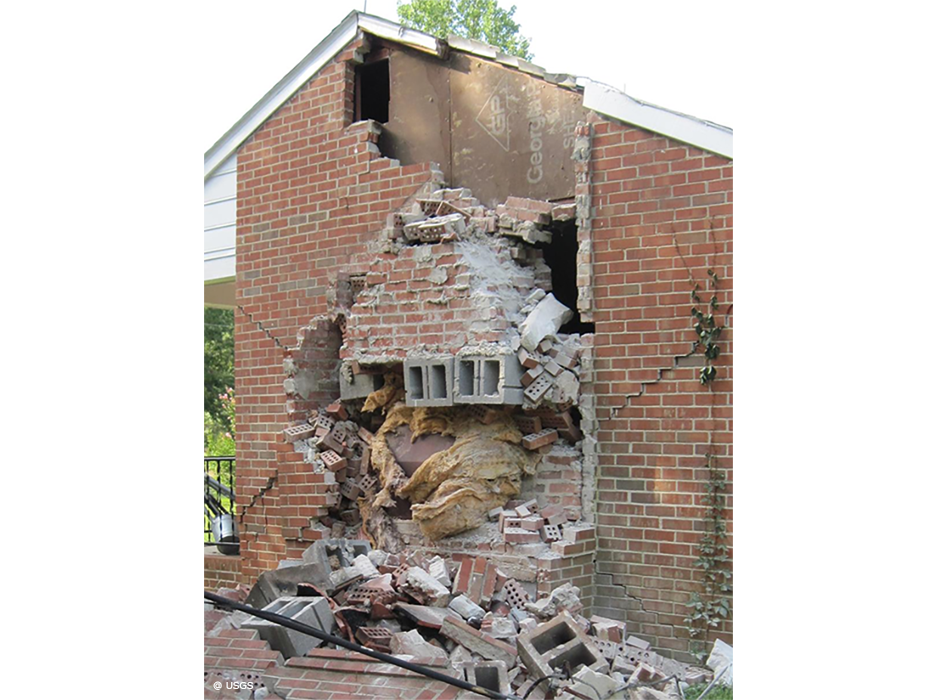
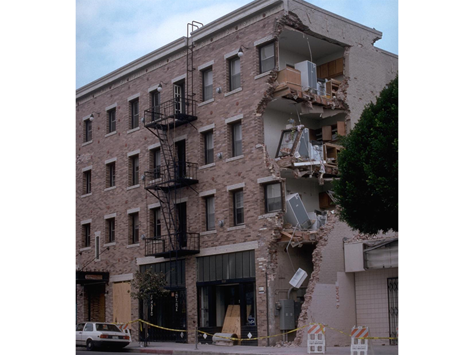
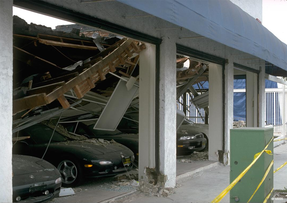
Damage to buildings can be expected starting from an intensity of around VI, which corresponds to a magnitude of approximately 5. Destructive damage is to be expected after an earthquake with an intensity of IX or above. Minor cracks or damage caused by falling objects can even occur at lower intensities.
However, earthquake also trigger other process and have secondary effects.
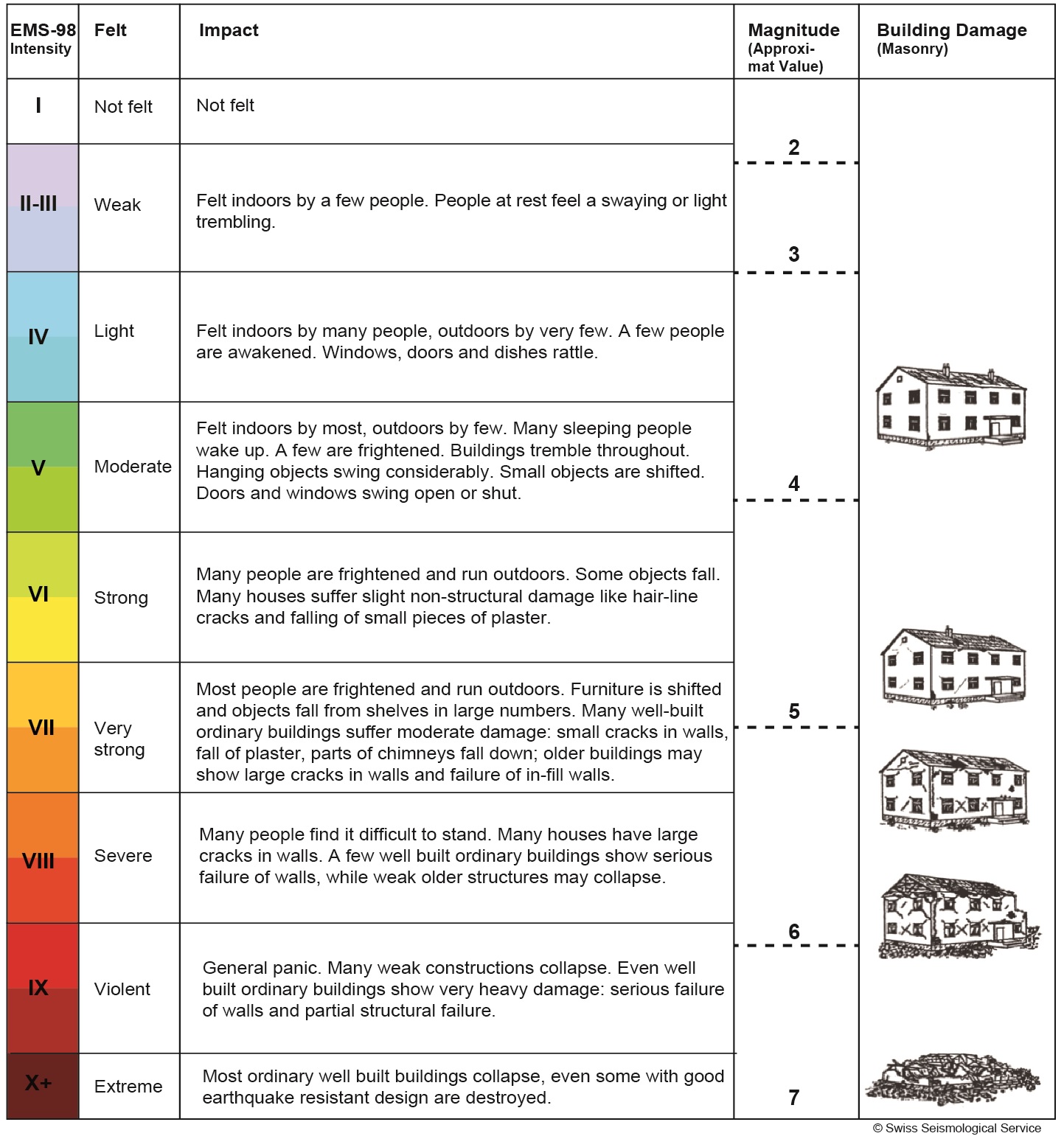
Potential consequences of earthquakes of different intensities and magnitudes
How does the local subsurface impact the effects of an earthquake?
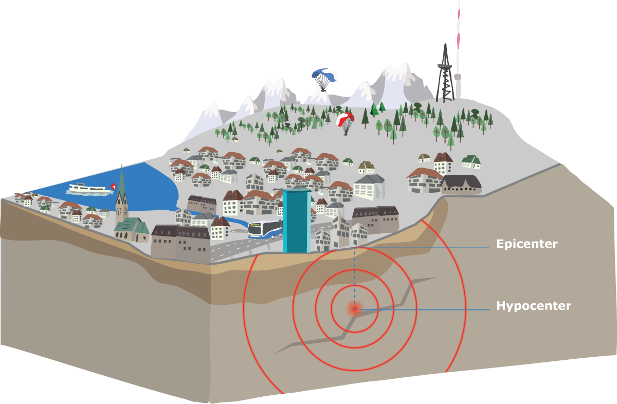
How clearly an earthquake is felt depends not only on its strength, but also on the depth of its seismic focus (hypocentre) and on the local subsoil.
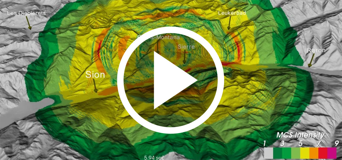
Earthquakes in soft ground (e.g. in valley sediments, lake deposits) are felt more than earthquakes in rocky subsoil. The type of subsoil in the locality also affects the resulting damage: earthquake waves in sediment-filled valleys (like the Rhone Valley) are 10 times stronger than in solid bedrock and cause correspondingly greater damage. As a rule, the more solid the subsoil beneath a building is, the less damage earthquake waves can cause.
Watch the video to see how the waves in a simulated earthquake in the Rhone Valley spread and how long they remain 'trapped' in the valley floor.
What other processes and effects can be triggered by earthquakes?
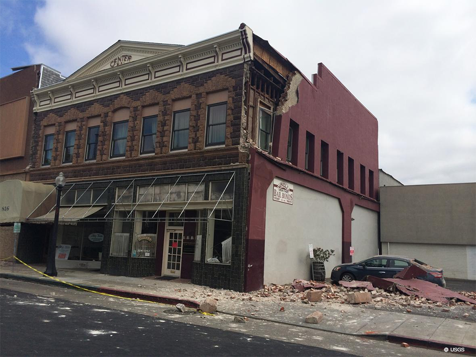
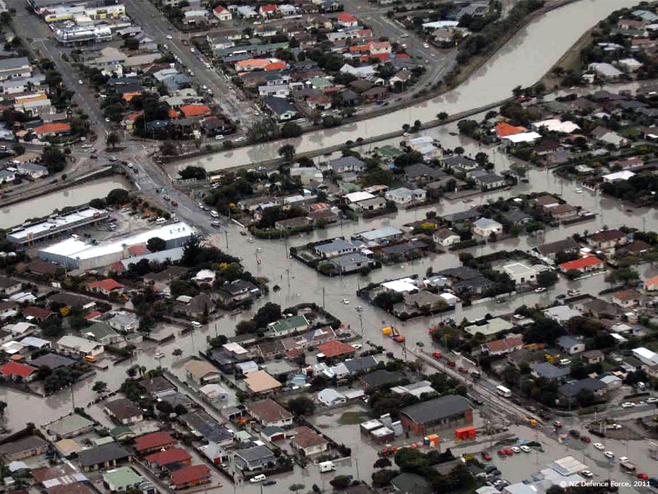
Earthquakes are not the only events that cause damage to buildings and infrastructure: earthquake-induced phenomena can as well, for example through soil liquefaction, landslides and tsunamis triggered by undersea landslides. Severe earthquakes also often lead to other effects such as fires (e.g. due to leaks in gas pipes) or supply interruptions (e.g. broken water pipes or electric cables).
Such indirect effects of earthquakes pose a further danger to the public when there are strong earthquakes and often cause a significant proportion of the overall damage.
Earthquakes trigger soil liquefaction in some places. The tremors cause the rock particles in the soil to lose their cohesion, meaning that the pore space is expanded, water can seep in and subsoil that was previously solid loses its strength. This phenomenon can occur where the soil is very waterlogged and not very compact. Therefore, sediments and loose rocks, such as those found in valleys, are particularly affected. Such soil liquefaction was, for example, observed in Switzerland after the magnitude-5.8 earthquake in Sierre in 1946.
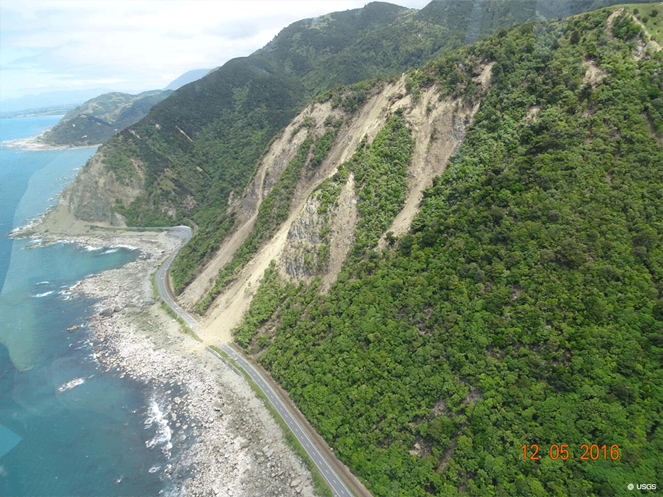
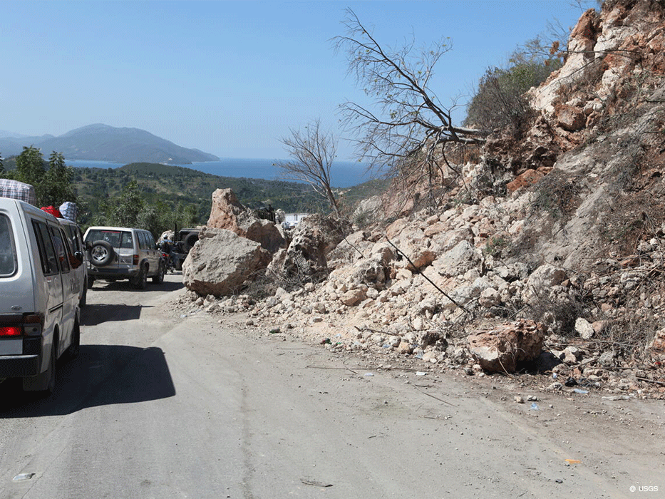
The tremors of earthquakes can provoke mass movements such as landslides, rockslides and avalanches, especially on steep, unstable slopes. The geological composition and topographical structure of the Alpine region contribute to the fact that slope instabilities and mass movements occur relatively frequently in Switzerland. However, due to advances in geophysical and seismological methods in recent years, it is now possible to investigate slope instability in detail. These methods analyse the natural vibration behaviour and the reaction of slopes to earthquakes and provide valuable information about their stability. Although potentially unstable slopes can thus be detected, mapped and monitored, knowledge about the influence of environmental conditions on the seismic behaviour of these slopes is still limited.
Tsunamis do not only occur in the sea. In rare instances, large seismic waves also occur in (Swiss) lakes. Tsunamis at sea occur when an earthquake abruptly raises or lowers the ocean floor and / or when a submarine landslide takes place.
The height and speed of tsunami waves depend on the parameters that triggered the quake and on the depth of the water. As a rule, waves propagated in deep water do not pose a danger and are recorded only by measurement buoys (if noticed at all). But as soon as they reach shallower waters, the mass of water towers high and can flood entire stretches of coastline, depending on the vertical displacement of the ground.
Lake tsunamis are usually caused by rock avalanches or sliding sediment, either above or below water, which are in turn often, though not always, triggered by earthquakes. The height of a tsunami wave caused by a submarine landslide depends mainly on the volume of sediment displaced and the speed of the landslide.
Flash floods in Switzerland
Evidence of rock avalanches and landslides that triggered flash floods in Switzerland's history and prehistory has been found in many Swiss lakes, taking the form of chaotically mixed deposits that differ markedly from normal sediments. Since their age can be ascertained, they can be retrospectively attributed to a seismic event. The height of the flash flood wave can be calculated by numerical models and then compared with historical reports.
The following flash floods in Swiss lakes have been historically documented:
- In 563 A.D., a rock avalanche in the Rhone Valley triggered a submarine landslide in the river's delta. This slide in turn generated a wave up to 13 m high, which swept over the bank of Lake Geneva, flooding the old city of Geneva (Kremer et al., 2012).
- In 1584, an earthquake near Aigle destroyed villages and caused rockslides. A tsunami in Lake Geneva was observed (Fritsche et al., 2012).
- On 18 September 1601, an earthquake with a magnitude of 5.9 caused submarine landslides in Lake Lucerne, triggering a 4-m-high tsunami wave that engulfed the city of Lucerne (Schnellmann et al., 2002; Siegenthaler et al., 1987).
- On 23 September 1687, parts of the Muota delta slid into Lake Lucerne, triggering a wave 5 m high (Hilbe and Anselmetti, 2014).
- On 2 September 1806, the village of Goldau was destroyed by a rock avalanche that caused a 10-m-high tsunami wave in Lake Lauerz (Bussmann and Anselmetti, 2010).
- In 1996, the remains of a human body between 190 and 290 years old were found in Lake Brienz, freed from the mud by a smallish landslide in the Aare delta that triggered a wave 1 m high. This unusual movement of water was observed by employees of the company Aarekies (Girardclos et al., 2007).
These historical examples show how different the causes of lake tsunamis can be and suggest that the possibility of future flash floods in Swiss lakes cannot be ruled out. However, there is no way of predicting where or when these phenomena may occur or what form they might take.

Example of a possible sequence of events: (1) A rock avalanche in the Rhone Valley in 563 A.D. triggered a (2) landslide in the Rhone delta that triggered a (3) flash flood that engulfed the old city of Geneva.
Kremer, K., Simpson, G., Girardclos, S., 2012. Giant Lake Geneva tsunami in AD 563. Nat. Geosci. 5, 756-757.
© USGS
© USGS
© USGS
©USGS
©USGS
© USGS
© USGS
© USGS
© USGS
© NZ Defence Force