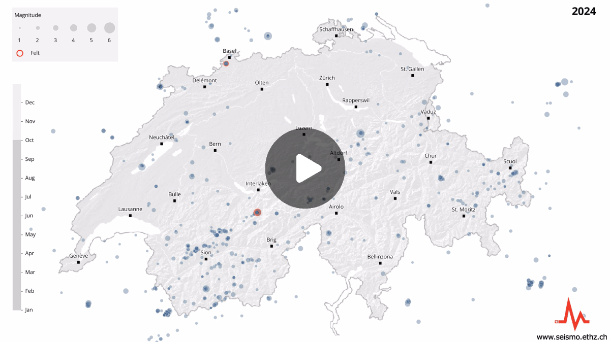
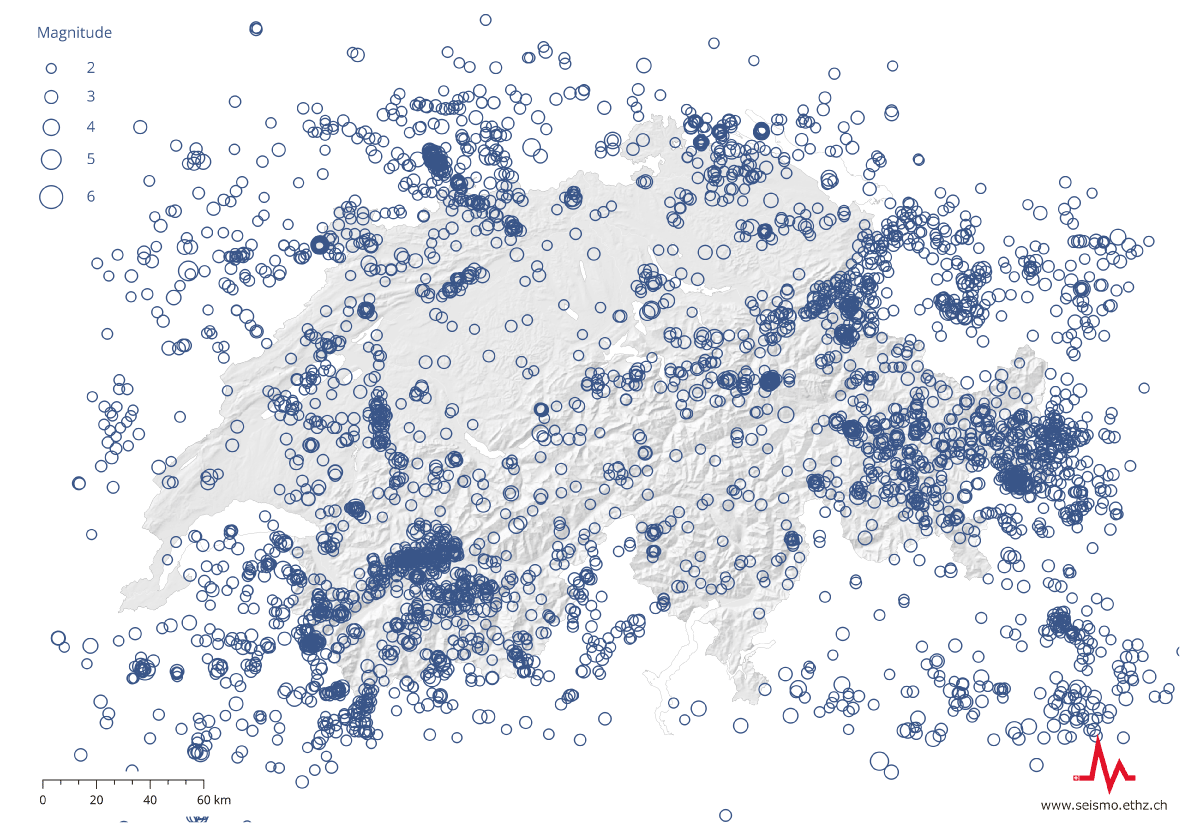
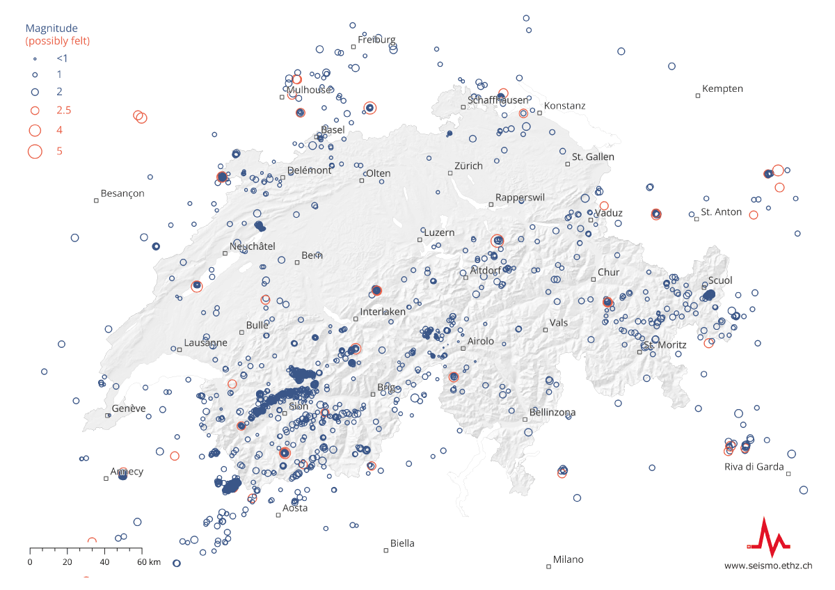
With its monitoring network of more than 200 seismometers, the Swiss Seismological Service (SED) at ETH Zurich records an average of between three and four earthquakes a day, or between 1,000 and 1,500 earthquakes a year, in Switzerland and its immediate neighbouring regions.
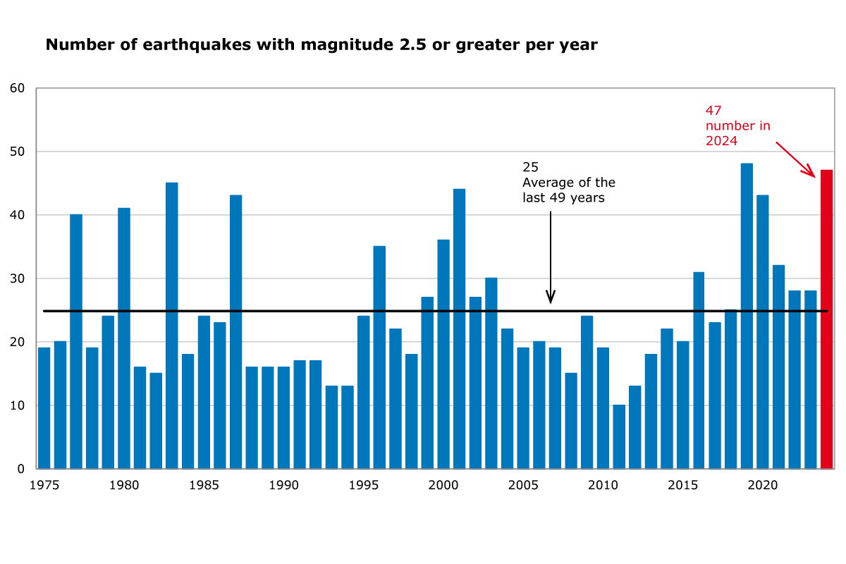
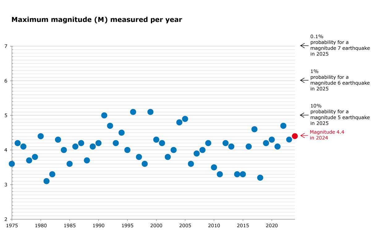
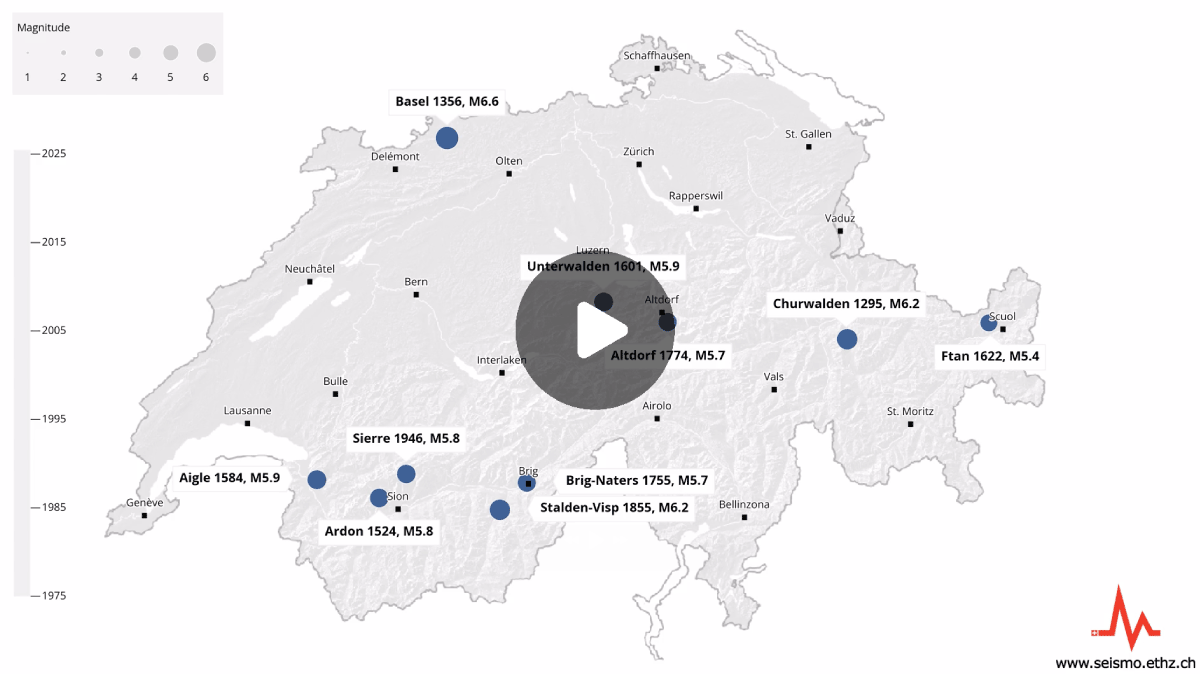
Swiss citizens actually feel somewhere between 10 and 20 quakes a year, usually those with a magnitude of 2.5 or above. Based on the long-term average, 24 quakes with a magnitude of 2.5 or above occur every year. There is a roughly 1% probability of a catastrophic earthquake with a magnitude of about 6 occurring within the next year. On average, an event of that magnitude can be expected to occur every 50 to 150 years in Switzerland or its neighbouring regions. The last earthquake of that strength occurred in 1946 near Sierre in the canton of Valais. However, such a quake can occur anywhere and at any time in Switzerland. Earthquakes with a magnitude of at least 5 occur every 8 to 15 years. The last earthquake to cause major damage in Switzerland had a magnitude of 5 and occurred near Vaz in the canton of Grisons in 1991. The strongest ever historically documented earthquake in Switzerland, with a magnitude of about 6.6, occurred near Basel in 1356.
Most of the earthquakes occurring in Switzerland are caused by collisions between the European and the African lithospheric plates. The number of earthquakes recorded depends not only on seismic activity, but also on the density and distribution of monitoring stations. Regions where many seismic stations have been set up, such as the canton of Valais or Eastern Switzerland, record comparatively higher numbers of quakes, because even very small events can be recorded and analysed. Moreover, in principle there is more small-scale than large-scale seismic activity. For example, more than 700 of the 1,230 earthquakes registered by the SED in 2017 had a magnitude of less than 1.0. In recent years, the number of recorded microquakes has greatly increased, due to the steady expansion of the measuring network and improved analytic methods. It is important to record such events because this allows geoscientists to learn more about the structure of the subsurface and to draw conclusions about the seismic hazard.
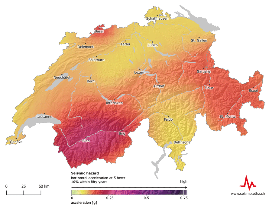
Compared to other European countries, Switzerland has a moderate earthquake hazard, but displays regional differences, the canton of Valais having the highest hazard, followed by Basel, Grisons, the St. Gallen Rhine Valley, Central Switzerland and then the rest of the country. Every region of Switzerland is exposed to some degree of seismic hazard.
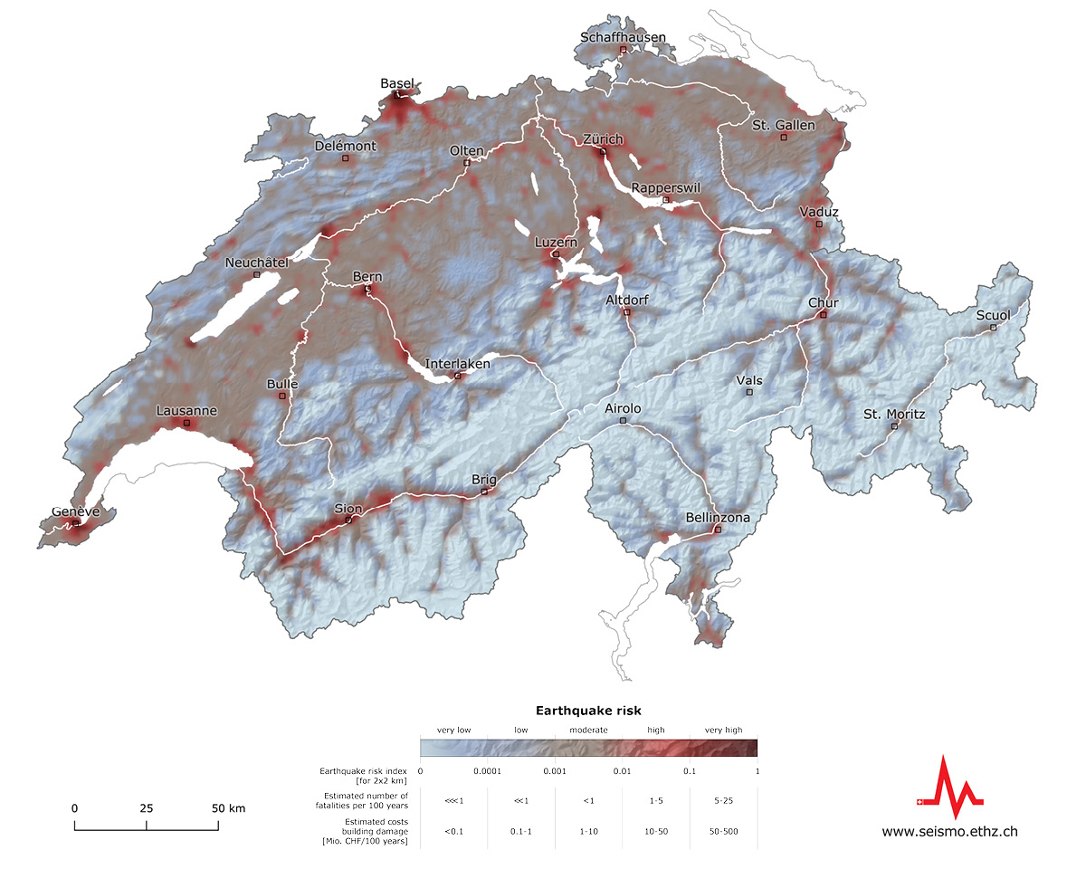
While earthquake hazard estimates how often and how strongly the ground could shake at given locations in the future, earthquake risk describes the effects on buildings and the associated financial and human losses. The greatest earthquake risk is in the cities of Basel, Geneva, Zurich, Lucerne and Bern, in that order. Although the earthquake hazard in these regions differs, all five cities have, by virtue of their size, a large number of people and assets that would be affected by an earthquake. In addition, these cities have many buildings, some particularly vulnerable and often located on soft ground that amplifies seismic waves.
