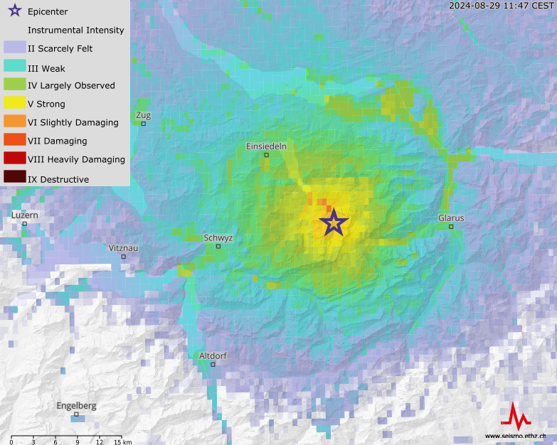
Basic ShakeMap information for the public can be found here.
ShakeMaps provide near-real-time maps of ground motion and shaking intensity following significant earthquakes. The SED ShakeMaps are automatically generated within a few minutes of an earthquake, using the actually observed ground motions as measured by every seismic station available to the seismic network. Felt reports can be also directly used in ShakeMap. The ShakeMap is revised when the magnitude and / or location changes following manual evaluation.
Our ShakeMaps are created using the codes distributed by the US Geological Survey, with modification suitable to the conditions in Switzerland. SED ShakeMaps are based on predictive equations for peak ground-motions and response spectra derived from stochastic simulations tailored to Swiss seismicity. The peak-motion parametric data that are used as input to ShakeMap are automatically computed by the software module scwfparam once a new SeisComP3 earthquake origin is available. Site amplification is accounted for based on macroseismic intensity increments for different soil classes as documented in the earthquake catalogue of Switzerland (ECOS-09), along with direct observations of ground motion amplification at each recording station. We convert ground-motion levels into macroseismic intensity by means of ground-motion to intensity conversion equations based on the Italian strong-motion and intensity databanks, suitable for application in the Swiss context. SED ShakeMaps are fully consistent with the state-of-the-art in engineering seismology in Switzerland. More details about SED ShakeMap can be found here.
Shakemaps are created for every earthquake above M2.5, and then shown on our event pages, modified from the original USGS style so they match the colour scheme and feel.
Strong Motion Waveform Parameterisation - scwfparam
scwfparam is a SeisComP3 module that rapidly provides automatic peak ground motion values from earthquakes, and provides input for ShakeMaps and the SED Strong-Motion Portal. scwfparam is also now widely used by other networks, and forms the basis of the ORFEUS RRSM.

ShakeMap of an earthqake near Elm on November 10, 2020 with magnitude 3.9. The hypocentre was located at a depth of about 1.7 kilometers.