| Local time | 2020-04-24 16:03:59 |
|---|---|
| UTC Time | 2020-04-24 14:03:59 |
| Event Type | quarry blast |
| Latitude / Longitude | 47.63 / 8.08 |
| Swiss Coordinates | 648371 / 275234 |
| Magnitude | 1.3 |
| Magnitude Type | MLh |
| Location | Laufenburg |
| Depth [km] | - |
| Location Type | manual |
| Agency | SED |
| Last Update | 24-04-2020 19:48:17 |
| Danger level | 0 (as defined by federal agencies with responsibility for natural hazards) |
| Origin ID & Metadata | smi:ch.ethz.sed/sc3a/origin/NLL.20200424194815.766976.689199 |
|
GSE 2.1 provisional format |
|---|
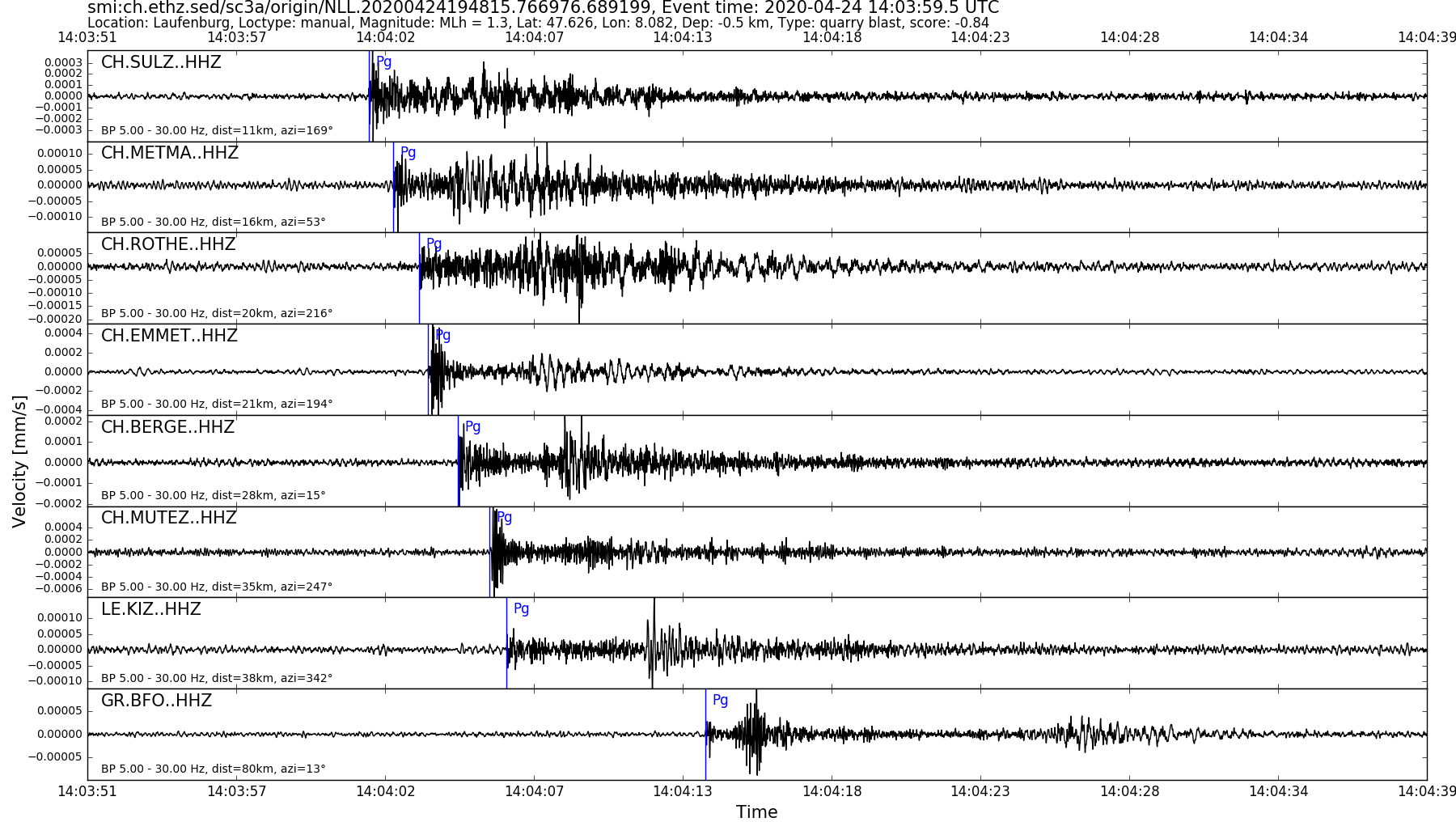
| BEGIN GSE2.1 MSG_TYPE DATA MSG_ID 2020/04/24_020906741 CHE_NDC DATA_TYPE BULLETIN GSE2.1:short Reviewed Event Bulletin (REB) of the CHE_NDC for April 24, 2020, 02:03:59.556 EVENT 2020/04/24_020359556 LAUFENBURG Date Time Err RMS Latitude Longitude Smaj Smin Az Depth Err Ndef Nsta Gap mdist Mdist Qual Author OrigID 2020/04/24 14:03:59.56 0.07 47.6256 8.0853 20038.4 2535.6 147 -0.5 4.4 8 8 118 0.10 1.19 a i uk SED -------- Magnitude Err Nsta Author OrigID MLh 1.3 0.2 6 SED -------- Sta Dist EvAz Phase Time TRes Azim AzRes Slow SRes Def SNR Amp Per Qual Magnitude ArrID SULZ 0.10 170.3 P 14:04:01.940 0.0 ___ 361.1 a__ MLh 1.6 -------- METMA 0.14 52.7 P 14:04:02.825 0.0 ___ 130.1 a__ MLh 1.3 -------- EMMET 0.19 195.1 P 14:04:04.055 0.0 ___ 201.3 a__ MLh 1.6 -------- BERGE 0.25 14.8 P 14:04:05.120 0.0 ___ 77.9 a__ MLh 1.3 -------- MUTEZ 0.32 248.1 P 14:04:06.310 0.0 ___ 63.6 a__ MLh 1.3 -------- KIZ 0.35 341.9 P 14:04:06.860 0.0 ___ 40.0 a__ MLh 1.2 -------- MTIA3 0.70 248.7 P 14:04:14.634 0.9 ___ a__ -------- BFO 0.72 13.0 P 14:04:13.918 ___ a__ -------- FIESA 1.19 179.8 P 14:04:23.385 0.5 ___ a__ -------- STOP |